
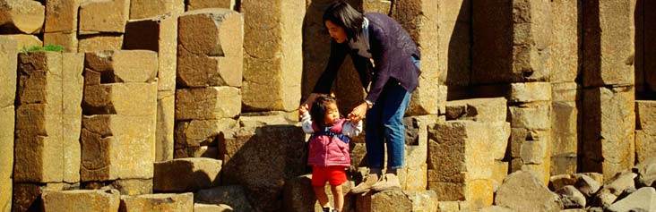
The Giant’s Causeway and Causeway Coast World Heritage Site (WHS) sits within the Causeway Coast Area of Outstanding Natural Beauty in the North of County Antrim, Northern Ireland.The Giant’s Causeway and Causeway Coast WHS is one of the premier tourist attractions in Northern Ireland. The new Giant’s Causeway Visitor Centre opened in June 2012 blending into the landscape, with walls of glass, basalt columns and a state of the art interior.
Villages near the WHS such as Bushmills, gateway to the Giant’s Causeway, Portballintrae, a small fishing village, the smaller settlement of Ballintoy, Portbradden, near White Park Bay and Lisnagunogue & Dunseverick with Dunserverick Castle close by all help to form the character of the area both in landscape and cultural terms.
Causeway Coast and Glens Heritage Trust have developed a great free interactive map which covers the whole Causeway Coastal Route call CCR Alive. This not only shows where the Giant’s Causeway and Causeway Coast WHS is, it puts in context of the surrounding area allowing you to learn about other key features in the area.
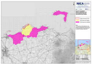
Below are a selection of maps which detail the WHS boundry and setting;